


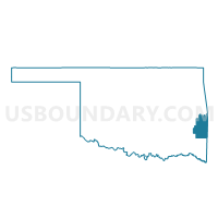
Voting District 312, Le Flore County, Oklahoma
About
Outline

Summary
| Unique Area Identifier | 654281 |
| Name | Voting District 312 |
| County | Le Flore County |
| State | Oklahoma |
| Area (square miles) | 39.18 |
| Land Area (square miles) | 38.66 |
| Water Area (square miles) | 0.52 |
| % of Land Area | 98.68 |
| % of Water Area | 1.32 |
| Latitude of the Internal Point | 34.81813600 |
| Longtitude of the Internal Point | -94.63668560 |
Maps


Graphs
Select a template below for downloading or customizing gragh for Voting District 312, Le Flore County, Oklahoma


Neighbors
Neighoring Voting District (by Name) Neighboring Voting District on the Map
- Voting District 305, Le Flore County, OK
- Voting District 306, Le Flore County, OK
- Voting District 307, Le Flore County, OK
- Voting District 309, Le Flore County, OK
- Voting District 310, Le Flore County, OK
- Voting District 311, Le Flore County, OK